Glenny’s very own - Squirrel Trail
Firstly with the MAP
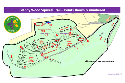
A - Give the Young People a copy of the Map with the signs position marked, in red, and numbers and they are ready to go…..
B - Give the Young People a copy of the MAP with just the signs position marked, in red, and they have to number them
C- Give the Young People a copy of the MAP with just the signs position marked, in red, and in advance you have added the numbers to the signs position dots you wish them to go to.
D - Give the Young People a blank copy of the MAP and they have to mark the positions and also number them
Please note you will need to print a master map per couple of groups for the YP to copy from. Don’t forget to collect the master map before they go sign hunting!!
3 suggestions below on how to then run the evening….
1 - Explore and just collect the letters - set a target of say 10 letters in 40 minutes…..
2 - Similar to one, although this time collect all the letters and use them to complete the anagram …. You can either use our examples or make up you own.
3 - As you will see in the sheets each letter has a value against them. Set a number and the young people go to the point make a note of the letter and then they get the points…. You could do this a couple of ways -
- Points collected when added together must equal a specific number.
- Points when collected must be greater than
The link to obtain the answers is included in the information provided on your booking confirmation and also 7 days prior to visit email
This activity is a chance for you to explore Glenny and have a lot of fun finding the Squirrel signs around the site.
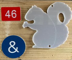
There are 26 numbered signs (1-26) - with letters A to Z on them placed within the site for you to find and make a note of the letter.
To undertake this activity there are various ways you can run it,
Safety
- Factsheet - This page is the fact sheet
- Bluebells - Also please remember during April / May / June and possible early July is the Bluebell season. Please avoid walking onthese plants as much as possible as they are very slippery and can cause nasty slips and falls. Also to avoid damaging the bluebell plants which make such a colourful display. Guidance at - Bluebells - >>>>
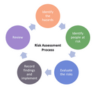
Risk Assessment for this activity
Click on the risk diagram
To book this Activity please go to OSM either direct or via our bookings page


